History of Osoyoos Lake and Area
Geological and Human
OSOYOOS comes from the first nation word ‘Sooyoos’ (‘suius‘ from Salish meaning ‘narrows of the lake’). There is a story that a Minister by the name of O’Reilly put the ‘o’ in front of ‘Sooyoos’ to harmonize with other nearby town names, while others have said that the ‘o’ could have been an ‘expression of the scenery by a white man’.
The native tongue spoken by most first nations people was Salish as well as their own language. The Colville native tribe used to fish for salmon just east of Osoyoos bridge but that finished when the first of 10 dams was built. The word ‘Okanagan’ has 36 variations from ‘Oak-an-argon’, ‘Oaschenawagan River’ but now only two remain – Okanagan in Canada and Okanogan in Washington State.
Geology

This wooden bridge was one of several that were built across the narrows where ‘Motel Row’ now stands. Copyright: Osoyoos Museum
Millions of years’ worth of earthquakes and volcanoes originally formed the land here. Some of the rocks, particularly the ‘gneiss’ (a form of granite) outcrops you see along the highway south of Penticton used to be part of the continental shelf, formed approximately two billion years ago and thought to be some of the oldest rocks on earth. About 130 million years ago, this valley was an inland sea, until what is known as the Pleistocene Ice Age which began two million years ago.
The last major glacial episode to affect the Southern Interior did not begin until 12-19,000 years ago when the Cordilleran Ice Mass filled the Okanagan Valley and covered the mountains to the east and west. The area is thought to have been under 7,000 feet of ice. After the retreat of the glaciers, some 9,000 years ago, glacial meltwater lakes formed and the valley sides were covered with vegetation such as lodgepole pine, ponderosa pine, grasses and sage brush.
Because of an underlying sandstone bed, we have what are known as ‘haystack rocks’ or ‘hoodoos’ (very visible on the west side of Highway 97 north of Penticton). During the melting and retreat of the ice cap over the land, meltwater became plugged and directed itself into streams. As it retreated, it formed meltwater channels which can still be seen on the east side of the lake, together with ‘Kame Terraces’ or benches, where the sediment leveled out. The ‘big melt’ caused massive volumes of water, sometimes 300 feet deep, travelling at 70 mph for over 1000 miles, which caused many unusual rock formations in Washington State down to the Pacific Ocean.
Also left from the period of glacial retreat are small ponds known as ‘kettles’, and these can be seen near Highway 97 locally, one example being opposite Reflections B & B Guest House. Several of these will almost dry up in early summer until around July 15th, when the huge aquifer on the west side refills them. Kilpoola Lake is also a result of the glacier. Core samples there show about 1/4 inch of ash from the Mazama Volcano eruption in Oregon (now known as Crater Lake), which occurred 7000 years ago. Only a skiff of ash from Mount St. Helens has been found here.
First Nations
According to archaeological studies, First Nations people have lived in the Okanagan Valley for 3500 to 4000 years. The Okanagan First Nations were traditionally a hunting and gathering society.
There are indications that non-native travellers may have been here in the 1500s, and also that some Spanish conquistadors came here searching for Eldorado: they got as far as Kelowna before they and most of their horses died during a severe winter. There is evidence of them found in some burial grounds.
It is likely that the first non-First Nations person to travel through the Okanagan was David Stuart who was in the employ of John Jacob Astor. He established Fort Okanagan at the junction of the Okanagan and Columbia Rivers in July of 1811 and then traveled north through the grasslands of the Okanagan Valley as far as the Shuswap.

One of the the wooden irrigation flumes used to carry water from the lake and river to orchards in Osoyoos. Copyright: Osoyoos Museum
Chronology
1858 – British Columbia became a Crown Colony, the result of a Bill passed in the British House of Commons.
1858 – the first cattle were driven up here by drovers (cowboys) from Oregon, having stopped at Fort Okanogan. They came up the Old Brigade Trail (used for the fur trade) on the west side of the lake on way to Fort Kamloops to feed the gold miners. Judge John Carmichael Haynes was the first customs officer in Osoyoos (1831-1888), charging $1.00 per head. The drovers wintered here because of the warm temperatures.
1859 – Ben Snipes and Jack Slawn lost 18 cattle due to mosquitoes in the swamps of Osoyoos Lake.
1859 – Adam Beam, a Canadian from Colville, found gold in Rock Creek east of Osoyoos. By May 1960, there were 500 miners in the area. Gold was trekked over Anarchist Mountain and over what is now Haynes Point to Vancouver (there being no bridge in those days).
1860-1861 – a 91-foot paddle boat called the S.S. Cascadilla was built at Osoyoos Lake. However, because of the O.K. Falls dam, it could not go higher up the valley and eventually was used in south Washington. It was built to run from Oroville to Penticton.
1861- first customs house built, with Judge J.C. Haynes charging $1.00 per head of cattle
1900 – Ted Kruger bought a canoe that was used to transport the body of Judge Haynes, and was subsequently used as a water reservoir. In 1960, the remains of the canoe were located east of the Osoyoos Bridge and is now at our Museum.
1917-1920 – Doug Fraser’s horses refused to drink the water from Osoyoos Lake in August, even though they had just come down all the way from Kilpoola.
1919-20 – Wooden ‘flumes’ were built for irrigation, and the following year Premier John Oliver promoted the irrigation system from Vaseaux Lake to the Border. The remains of the system, which became known as the Ditch, can still be seen and parts are still used. West of Osoyoos, a beautiful gravel walkway meanders along through the desert scenery of the old Irrigation Canal. The ‘Golden Mile’ winery walk is along the irrigation channel. Wooden flumes can still be seen on the west side of the Highway in Oroville, Wa. and many other areas.
1927- the Zosel Dam was built at the south end of the lake, Mr. Zosel having made the original to use the water for a log sorting pond. This is the only dam that has a ‘back flow’ allowing the water from the Similkameen River to back up into Lake Osoyoos during heavy run-offs.


Severe flooding in the 1940s (above) led to the channelization of the Okanagan River (below). Photos copyright: Osoyoos Museum.

1945 – International Joint Board of Control was formed to control the levels of the lake.
1951- Okanagan River north of Osoyoos Lake was channelised and straightened for flood control purposes.
1950s – present – July 1st Cherry Fiesta fireworks began. In the past 20 years (since 1996), it has become one of the largest and most popular Canada Day fireworks displays in B.C.
1960-70 – raft races were held on the lake.
1963 – Osoyoos Sailing Club was formed.
1965-1970 – sailboats with lanterns parade on the lake.
1969 – Okanagan Basin Water Board was formed.
1969 – BC Ministry of Environment began using observation wells to test levels of water in Osoyoos aquifers, as part of a province-wide program. In 2003 the Osoyoos Lake Water Quality Society was given the contract and continues testing to this day.
1969-1980 – Osoyoos Lake Hydroplane races (Osoyoos Power Boat Squadron/Rotary Club/Kinsmen). Also parade with lights on July 1st.
1972 – B.C. Government declares Osoyoos Lake as ‘fragile’.
1972 – Submarine photometry study conducted on lake.
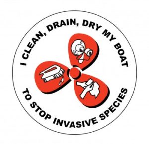
1975 – Probably via boat launches, Eurasian milfoil introduced in the lake.
1978-1989 – Test carried out for mercury, toxins and DDT, were found in fish.
1979 – Okanagan Basin Study conducted with 47 recommendations made, few of which have been initiated to date.
1983 – Old Osoyoos CPR Station saved from landfill and moved to present site of Osoyoos Sailing Club.
1989 – South Okanagan Lake Enhancement Society formed.
1991 – Study completed by Okanagan University Water Technology Dept (funded by local businessmen) found Osoyoos Lake to be a ‘nutrient cocktail of phosphates and nitrates’.
1991 – Osoyoos Lake Water Quality Society formed.
1993 to present day – Osoyoos Lake Water Quality Society began taking weekly tests of the lake water (during summer months) for Ministry of Environment, providing a comprehensive record of water quality trends over many years.
1993/4/5 – herbicide/pesticide and other tests conducted on lake.
1995 July 1st – first canoe race across the lake was held.
1996 to present – Osoyoos Lake Water Quality Society started marking storm drains with painted yellow fish (federal program) to remind the public that what goes down drains (toxins etc) goes into the lake.
1996 – B.C. Water Quality Status report listed Osoyoos Lake as ‘poor’ with high levels of phosphorous, causing excessive growths of algae.
1998 onwards – increased numbers of Canada Geese, causing problems with their droppings in public parks, beaches, etc
2001 onwards – a population and development boom increased pressure on the lake from lakeside construction, boat moorages, increased boat traffic, and the removal of natural lakeshore trees, plants, gravel beds etc and replacing them with turf grass and concrete walls.
2005 – sewers were hooked up to the east Lakeshore Drive area.
2006 – Interior Health began testing Osoyoos beaches again for fecal coliform after a lapse of several years due to funding cutbacks.
2006 – Okanagan Regional Goose Management Committtee released a report outlining a valley-wide plan to control goose numbers in the Okanagan.

Early orchards on the shores of Osoyoos Lake. Copyright: Osoyoos Museum
![]()
![]()
![]()